Web Interface
The EO4MULTIHAZARDS portal's web interface consists of two main pages:
- Home page
- Event detail page
This section of the documentation aims to describe the filtering tools available on these pages to customize your event search experience.
Home page
The Home page sections are listed below in order from top to bottom:
- Menu
- Main map
- Filtering tools
- Events table
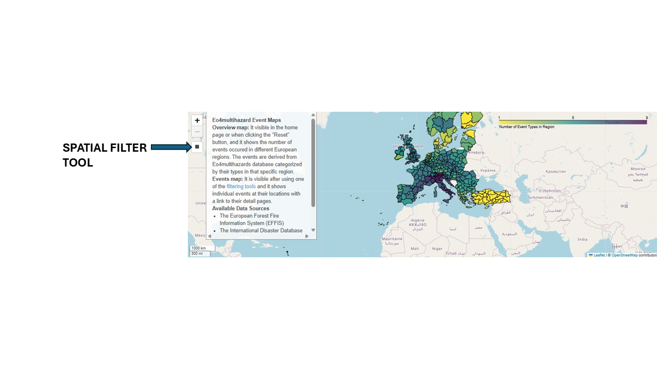
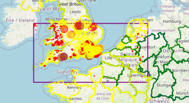
The main map on the homepage shows the number of event categories by region using the NUTS Level 2 layer. The map's colour bar appears in the top right. The darker the colour, the higher the number of event categories in the specific NUTS polygon. There are three map tools in the top right. The "+" and "-" buttons control the zoom. The last button, which looks like a square, is the spatial filtering tool. Filtering can require additional time due to the large volume of events and the process of loading event geometries on the map. Please allow a few seconds for processing. When event geometry is present in the input data, it appears on the map once filters have been applied. If geometry data is not accessible, the closest features are allocated based on the location details provided in the input dataset. Some events use multiple geometries to outline their area.
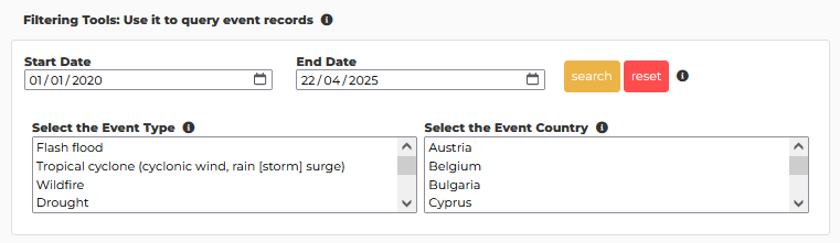
The filtering tools allow you to filter events on the map and in the table below. This is useful because displaying all the collected events at once on the map is not possible. The tools also allow you to better investigate countries, times, and event categories of interest.
The events table shows the events visible on the map. You can view the complete list of events when you first load the webpage or click the "Reset" button in the filtering tools. Running a query with spatial or other filters reduces and synchronizes the visible events in the table. After using a filtering tool, the main map displays the selected event features and the events table displays the selected event information, along with a link to access additional details.
Events detail page
The [event detail page](/detail) provides additional information about the event you selected:
- General information
- Related events table: all events that occurred within the selected spatial and temporal range.
- related datasets table: selected useful datasets that cover the spatial area and temporal range of the selected event.