 EDP metadata catalog
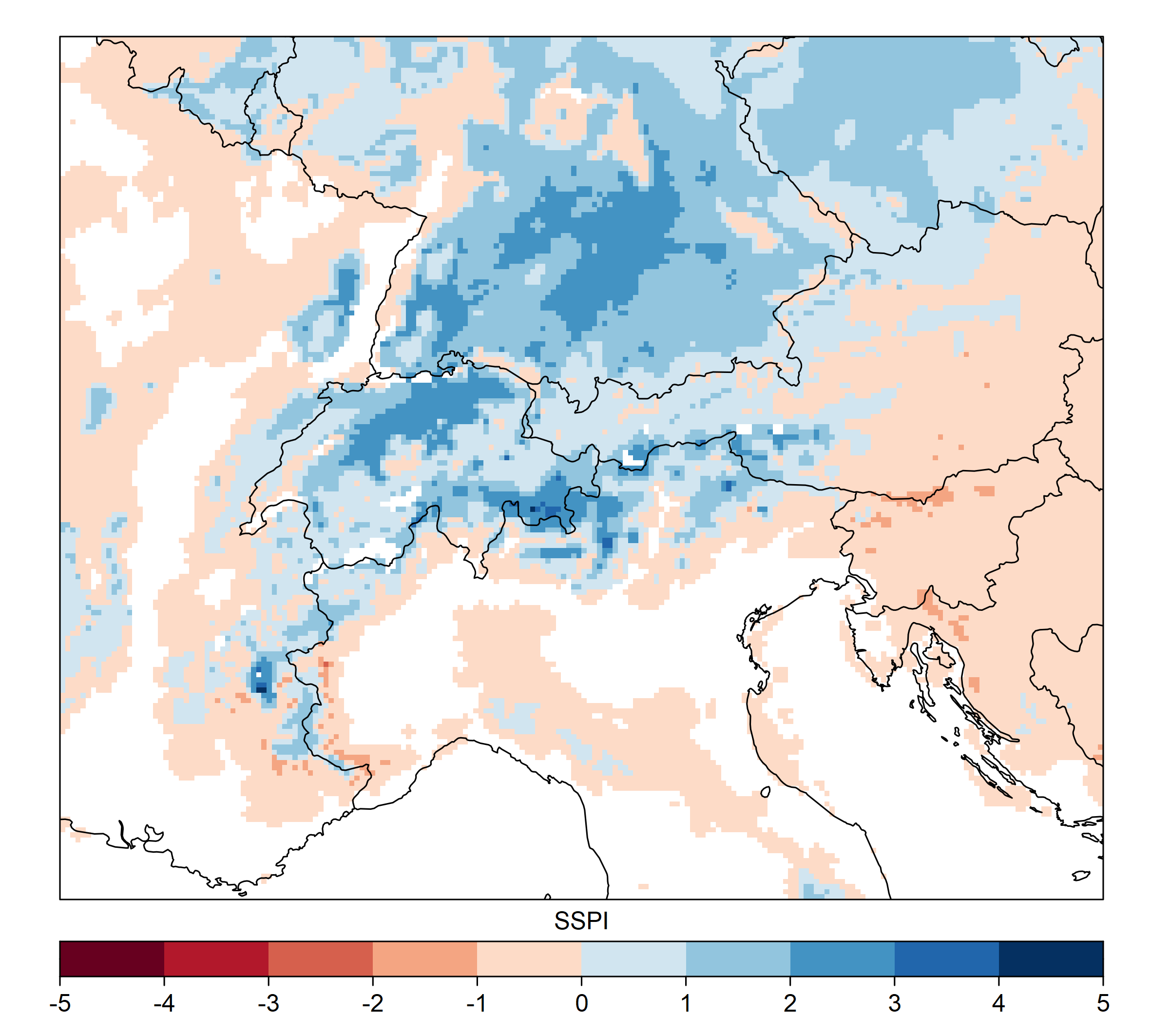
Standardised Snow Pack Index - ERA5_QM SSPI-30
The Standardized Snow Pack Index (SSPI) represents a standardized measure of what a certain value of snow water equivalent (SWE) averaged over the selected time period means in relation to the expected value for this period. SSPI is computed the same way as the SPI (using gamma distribution), except for being based on daily SWE timeseries instead of daily precipitation. It is calculated using the average SWE over a period of 10 and 30 days. The value of the SSPI index around 0 represents the normal expected conditions for the average SWE in the selected period based on the long-term average (1981-2020). The value of 1 represents approximately one standard deviation of the surplus, while the value of -1 is about one standard deviation of the deficit. SWE data used as input for the calculation of SSPI are derived using a modified version of the deterministic snow model SNOWGRID-CL, with downscaled ERA5 data used as model input data. Contains modified Copernicus Climate Change Service information [1978-current year]; Contains modified Copernicus Atmosphere Monitoring Service information [1978-current year].
Simple
Identification info
- Alternate title
-
ADO_SSPI_30d_SNOWGRID
- Date (Creation)
- 2024-10-01T09:51:01
- Date (Publication)
- 2024-10-01T09:51:01
- Edition
-
v1
- Citation identifier
- https://openeo.eurac.edu/collections/ADO_SSPI_30d_SNOWGRID/publisher
- Presentation form
- Digital map
- Purpose
-
Olefs, Marc, Roland Koch, Wolfgang Schöner, and Thomas Marke. (2020): Changes in Snow Depth, Snow Cover Duration, and Potential Snowmaking Conditions in Austria, 1961–2020—A Model Based Approach Atmosphere 11, no. 12: 1330. https://doi.org/10.3390/atmos11121330. EDO Indicator Fact Sheet: Standardised Snow Pack Index: https://edo.jrc.ec.europa.eu/documents/factsheets/factsheet_sspi.pdf
- Status
- On going
- Point of contact
-
Role Organisation Electronic mail address Custodian Eurac Research - Institute for Earth Observation
- Spatial representation type
- Grid
- Topic category
-
- Imagery base maps earth cover
Extent
Temporal extent
- Time period
- 1978-12-31T12:00:00Z 2023-11-27T12:00:00Z
Extent
))
- Maintenance and update frequency
- As needed
- GEMET - INSPIRE themes, version 1.0
-
-
Land use
-
Land cover
-
- Product
-
-
collection
-
SSPI
-
standardised snow pack index
-
ERA5
-
SNOWGRID
-
cct
-
- Platform
-
-
N/A
-
Resource constraints
- Use limitation
-
CC BY 4.0
- Access constraints
- Other restrictions
- Other constraints
-
CC BY 4.0
- Supplemental Information
-
Additional information can be added here
Content Information
- Attribute description
- Minimum value for cloud coverage
- Cloud cover percentage
- 0.0
Content Information
- Attribute description
- Maximum value for cloud coverage
- Cloud cover percentage
- 0.0
Content Information
- Attribute description
- Band: SSPI30
- Content type
- Auxillary Information
- Description
-
Mean wavelength value for the SSPI30 band
- Maximum value
- 0
- Minimum value
- 0
- Identifier
- https://www.bipm.org/en/measurement-units/
- Name
- nanometer
Distribution Information
- Distribution format
-
-
WCS
-
- Distributor contact
-
Role Organisation Electronic mail address Publisher Institute for Earth Observation
- OnLine resource
-
ADO_SSPI_30d_SNOWGRID
Open Application Programming Interface for Earth Observation. More information here: https://openeo.org/documentation/1.0/developers/
OnLine resource
- Website
-
Digital Object Identifier (DOI)
Slovenian Environment Agency, & Central Institution for Meteorology and Geodynamics. (2022). Standardised Snow Pack Index - ERA5_QM SSPI-30 (Version 1.0) [Data set]. Eurac Research. https://doi.org/10.48784/bd079696-7942-11ec-b64b-02000a08f41d
- OnLine resource
-
Digital Object Identifier (DOI)
Slovenian Environment Agency, & Central Institution for Meteorology and Geodynamics. (2022). Standardised Snow Pack Index - ERA5_QM SSPI-30 (Version 1.0) [Data set]. Eurac Research. https://doi.org/10.48784/bd079696-7942-11ec-b64b-02000a08f41d
Data quality info
- Hierarchy level
- Dataset
Report
- Measure identification
- INSPIRE/Conformity_001
Result
- Title
-
COMMISSION REGULATION (EU) No 1089/2010 of 23 November 2010 implementing Directive 2007/2/EC of the European Parliament and of the Council as regards interoperability of spatial data sets and services
- Explanation
-
See technical references
Resource lineage
- Statement
-
Not Available
- Hierarchy level
- Dataset
Spatial representation info
- Number of dimensions
- 2
- Dimension name
- Row
- Resolution
- 0.0 m
- Dimension description
-
dims description
- Dimension name
- Column
- Resolution
- 0.0
- Dimension description
-
dims description
- Cell geometry
- Area
- Transformation parameter availability
- false
Reference System Information
- Reference system identifier
- EPSG/3035
- Reference system type
- Projected
- Hierarchy level
- Collection hardware
Instrument
- Title
-
N/A
- Description
-
Text description of the instrument (if necessary)
Platform
- Sponsor
-
Role Organisation Electronic mail address Funder European Space Agency - Copernicus program
- Maintenance and update frequency
- As needed
Metadata
- Metadata identifier
- urn:uuid/6689c0a8-2351-11ef-9957-8d8b4d692a59
- Language
- English
- Character encoding
- UTF8
- Contact
-
Role Organisation Electronic mail address Point of contact Eurac Research - Institute for Earth Observation
Type of resource
- Resource scope
- Dataset
- Date info (Revision)
- 2025-09-11T09:24:52Z
- Date info (Creation)
- 2024-10-01T09:51:01
Metadata standard
- Title
-
ISO 19115-3
Overviews
Spatial extent
Provided by