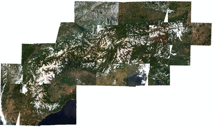
The collection contains binary snow cover maps covering the entire Alpine Arc. The maps have a daily frequency and a ground resolution of 250 m. They are derived from daily MODIS observations (Aqua and Terra) for the entire Alps arc. The input data are the atmospherically-corrected reflectances of MODIS MOD09GQ, MOD09GA for tile h19v04 and h18v04. The map has two bands - SNOW MAP: Snow cover classification map with four classes [0 = NO DATA - missing or corrupt data of one or more input bands; 1 = SNOW - pixel covered by snow; 2 = NO_SNOW - pixel not covered by snow; 3 = CLOUD - pixel covered by clouds; 4 = OCEAN WATER - pixel over sea and ocean; 5 = INLAND WATER - pixel over lakes and rivers], QUALITY FLAG: Snow cover quality map [NO DATA - missing or corrupt data of one or more input bands; QUALITY_INDEX - higher values indicate higher likeliness of correct classification].
collection, SNOW, MODIS, snow map, Alps, cct, Aqua, Terra, Land use, Land cover
CC-BY-4.0
| Eurac Research - Institute for Earth Observation |
| bartolomeo.ventura@eurac.edu |
| Viale Druso, 1 / Drususallee 1, Eurac Research, Bolzano, Autonomous Province of Bolzano, 39100, Italy |


2002-07-03T12:00:00Z  2024-09-22T12:00:00Z
WGS-84 (3035:EPSG)
Grid
mapDigital
Imagery base maps earth cover
install.packages("openeo")
library(openeo)

# login ----
host = "https://openeo.eurac.edu"
con = connect(host = host)
login()

# check login ---
con$isConnected()
con$isLoggedIn()
describe_account()

# load collection - save result ----
p = processes()
data = p$load_collection(id = "ALPS_SNOW_map_MODIS",
                                             spatial_extent = list(west = 4.216447,
                                                                                 east = 18.990556,
                                                                                 south = 42.817153,
                                                                                 north = 48.601848),
                                             temporal_extent = list("2002-07-03T12:00:00Z", "2024-09-22T12:00:00Z"))
result = p$save_result(data = data, format="netCDF")

# download results ----
# either directly (suitable for smaller requests)
compute_result(result,
                             format = "netCDF",
                             output_file = "ALPS_SNOW_map_MODIS.nc",
                             con = con)

# or start a batch job (suitable for larger requests)
job_id = create_job(graph = result,
                                   title = "ALPS_SNOW_map_MODIS",
                                   description = "ALPS_SNOW_map_MODIS",
                                   format = "netCDF")
start_job(job = job_id)
result_list = list_results(job = job_id)
download_results(job = job_id, folder = ".")#pip install openeo
import openeo
# login ----
euracHost = "https://openeo.eurac.edu"
conn = openeo.connect(euracHost).authenticate_oidc(client_id="openEO_PKCE")
# load collection - save result ----
data = conn.load_collection("ALPS_SNOW_map_MODIS",spatial_extent={'west':4.216447,'east':18.990556,'south':42.817153,'north':48.601848},temporal_extent=["2002-07-03T12:00:00Z", "2024-09-22T12:00:00Z"])
result = data.save_result(format="NetCDF")
# download results ----
# either directly (suitable for smaller requests, closes the connection after 2 minutes)
result.download("ALPS_SNOW_map_MODIS.nc",format="netCDF")
# or start a batch job (suitable for larger requests, e.g. when .download() timeouts)
job = result.create_job(title = "ALPS_SNOW_map_MODIS",description = "ALPS_SNOW_map_MODIS",out_format = "netCDF")
jobId = job.job_id
job.start_job()
jobResults = job.get_results()
jobResults.download_files('.')| Name | Description | Link | Date published | Category |
|---|---|---|---|---|
| openEO for ADO project | Tutorial and snippets on how to use openEO in the ADO project | Link | Sept. 15, 2021 | OpenEO |
| EDP video tutorial | Presentation of edp-platform and tutorial for data analysis and processing | Link | Sept. 15, 2021 | OpenEO |
| Official OpenEO documentation and project site | Official Documentation provided in the project web site for a deeper overview and introduction. | Link | June 10, 2021 | OpenEO |
| OpenEO doc | Documentation for OpenEO API | Link | June 9, 2021 | OpenEO |
| Eurac - OpenEO | openEO endpoint | Link | April 28, 2021 | OpenEO |
| MOOC Cubes and Clouds | Free Online Course teaching the concepts of data cubes, cloud platforms and open science in geospatial and EO. | Link | March 8, 2024 | OpenEO, STAC |