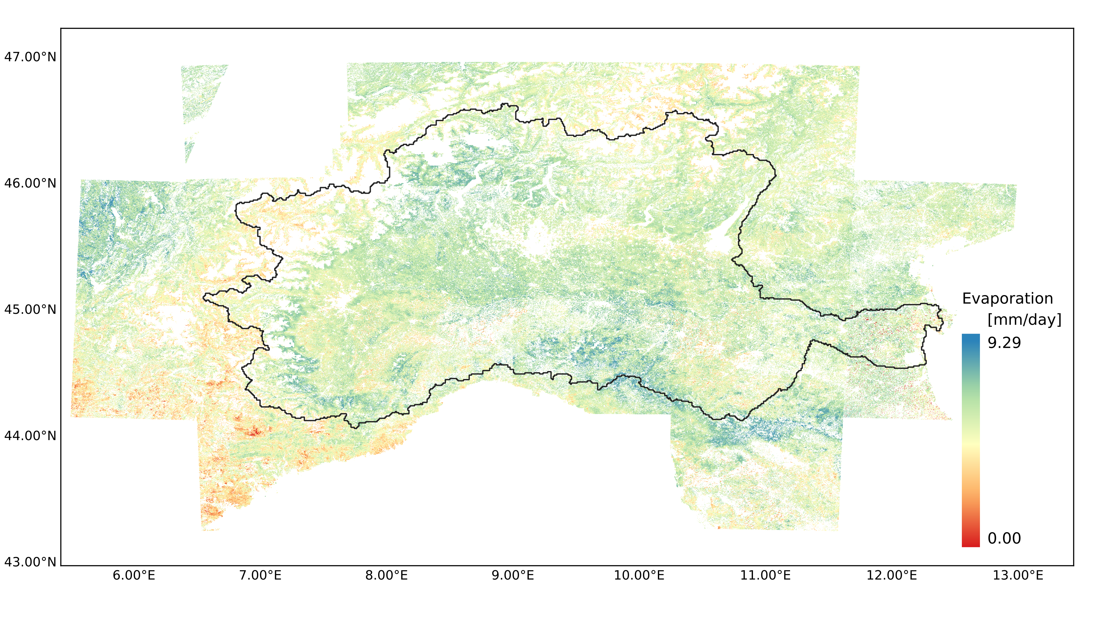
Evaporation (E) is the estimated flux of water evaporated from land surface, including vegetation and bare soil. The product is generated from Two-source Energy Balance (TSEB) model forced by ESA Copernicus Sentinel-2A/B MSI and Sentinel-3A/B SLSTR LST imagery together with ECMWF ERA5 reanalysis data. Evaporation maps are available at 100-m spatial resolution for the period 2017-2021 over Po basin in Italy. The spatial extent corresponds to Sentinel-2 tiling grids overlapping with the study area. The E layer contains one single band with evaporation values per day [mm/day] corresponding to Sentinel-3 acquisition day. Invalid pixels, mainly due to cloud contamination and lack of the input data for TSEB, are filled with NaN values. Evaporation outputs are generated in Cloud Optimized GeoTIFF (COG) format with metadata included in the file attributes. Datasets are available for each month (Jan-Dec) of the year separately in the form of stacked daily E observations.
Bartkowiak, P., Ventura, B., Jacob, A., & Castelli, M. (2023). Daily evaporation product - Po basin (Version v1) [Data set]. Institute for Earth Observation. https://doi.org/10.48784/7ABDBD94-DDFE-48DF-AB09-341AD2F52E47
Collection, Daily evaporation, TSEB, Sentinel, 4DMED project, 4DMED, Po basin, cct, Hydrography
CC BY 4.0
| eurac research - Institute for Earth Observation |
| bartolomeo.ventura@eurac.edu |
| Viale Druso, 1 / Drususallee 1, eurac research, Bolzano, Autonomous Province of Bolzano, 39100, Italy |


2017-01-01T12:00:00Z  2021-12-31T12:00:00Z
4326 (4326:EPSG)
Grid
Imagery base maps earth cover
##### ----Explore and download STAC data with Python ----- #####

from pystac_client import Client

## Read the example catalog
URL = 'https://stac.eurac.edu/'
catalog = Client.open(URL)

## List the Collections in the given Catalog
stac_collections = list(catalog.get_collections())
print(f"Number of collections: {len(stac_collections)}")

## Print collection IDs
print("Collections IDs:")
for collection in stac_collections:
    print(f"- {collection.id}")
print("-------------------------")

## Retrieve a specific collection
collection = catalog.get_collection("ID_OfTheCollection")

## Search for items in the collection
collection_items = list(catalog.search(collections=['ID_OfTheCollection'], max_items=10).items())
print(collection_items)

## Retrieve a list of the first 10 items belonging to a specific collection
item = collection.get_item("NameOfTheItem")
#print(list(item.assets.items())[0:10])

##Print the band name and the href of a specific item retrieved from the previous list
print(item.assets["ID_OfTheCollection"].title)
print(item.assets["ID_OfTheCollection"].href)

## Print Item’s assets through the assets attribute, which is a dictionary
for asset_key in item.assets:
    asset = item.assets[asset_key]
    print("{}: {} ({})".format(asset_key, asset.href, asset.media_type))

## ------------- DONWLOAD COG files from a specific collection ------- ####
from pystac_client import Client
import requests

## Read the example catalog
URL = 'https://stac.eurac.edu/'
catalog = Client.open(URL)

## List the Collections in the given Catalog
stac_collections = list(catalog.get_collections())
# print(f"Number of collections: {len(stac_collections)}")

## Print collection IDs
print("Collections IDs:")
for collection in stac_collections:
	print(f"- {collection.id}")
print("-------------------------")

## Retrieve a specific collection
collection = catalog.get_collection("ID_OfTheCollection")

## Search for items in the collection
collection_items = list(catalog.search(collections=['ID_OfTheCollection'], max_items=10).items())
print(collection_items)

url_basepath = "https://eurac-eo.s3-eu-west-1.amazonaws.com/"
collection_url = url_basepath + "ID_OfTheCollection" + "/"
print(collection_url)
for item_id in collection_items:
	# item = item.assets[asset_key]
	print(item_id.id)
	cog_file = str(item_id.id + '.tif')
	url = collection_url + cog_file
	response = requests.get(url)
	with open(cog_file, "wb") as f:
f.write(response.content)| Name | Description | Link | Date published | Category |
|---|---|---|---|---|
| MOOC Cubes and Clouds | Free Online Course teaching the concepts of data cubes, cloud platforms and open science in geospatial and EO. | Link | March 8, 2024 | OpenEO, STAC |
| STAC guidelines | Documentation to browse and download items of the STAC catalog | Link | Feb. 22, 2024 | STAC |