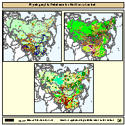
Physiographic maps for the CIS and Baltic States (CIS_BS), Mongolia, China and Taiwan Province of China. Between the three regions (China, Mongolia, and CIS_BS countries) DCW boundaries were introduced. There are no DCW boundaries between Russian Federation and the rest of the new countries of the CIS_BS. The original physiographic map of China includes the Chinese border between India and China, which extends beyond the Indian border line, and the South China Sea islands (no physiographic information is present for islands in the South China Sea). The use of these country boundaries does not imply the expression of any opinion whatsoever on the part of FAO concerning the legal or constitutional states of any country, territory, or sea area, or concerning delimitation of frontiers. The Maps visualize the items LANDF, HYPSO, SLOPE that correspond to Landform, Hypsometry and Slope.
Eurasia, physiography, soil


2000-01-01T04:29:00  2008-01-08T04:29:00
Lambert Azimuthal Projection (Lambert Azimuthal Projection:)
vector
geoscientificInformation
| Name | Description | Link | Date published | Category |
|---|---|---|---|---|
| Maps web services URLs | Here you can find all the available web service URLs provided by Maps, to consume datasets through an interoperable client (QGIS, Python, etc.) or to develop codes for analysis. The most relevant services to access datasets are: WMS (Web Map Service) to visualize layers in a map and to query them); WFS (Web Feature Service) or WCS (Web Coverage Service) to download raw datsets and use them for deep analysis or transformation. | Link | Dec. 13, 2021 | Maps |
| maps.eurac.edu documentation | maps.eurac.edu is based on Geonode, here the link to the official documentation | Link | April 28, 2021 | Maps |