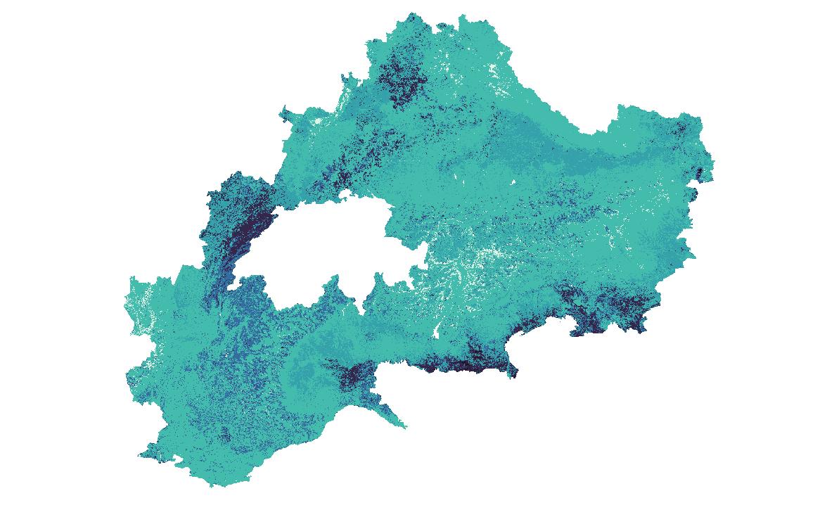
USDA soil textural classes derived from clay, silt and sand maps. - Resolution: 500m - Geographical Coverage: Alpine space - Input data: LUCAS 2009 Topsoil- Model: Multivariate Additive Regression Splines (MARS) - Year: 2015- Soil texture is classified into 12 classes: 1: Clay, 2: Silty-Clay, 3: Silty Clay-Loam, 4: Sandy Clay, 5: Sandy Clay-Loam, 6: Clay-Loam, 7: Silt, 8: Silt-Loam, 9: Loam, 10: Sand, 11: Loam Sand, 12: Sandy Loam. For further information visit the website European soil data centre (ESDAC).
collection, soil texture, soil textural classes, ESDAC, LUCAS, topsoil, ADO project, ADO, N/A, Land use, Land cover
CC BY 4.0
| Eurac Research - Institute for Earth Observation |
| bartolomeo.ventura@eurac.edu |
| Viale Druso, 1 / Drususallee 1, Eurac Research, Bolzano, Autonomous Province of Bolzano, 39100, Italy |


WGS-84 (3035:EPSG)
Grid
mapDigital
Imagery base maps earth cover
install.packages("openeo")
library(openeo)

# login ----
host = "https://openeo.eurac.edu"
con = connect(host = host)
login()

# check login ---
con$isConnected()
con$isLoggedIn()
describe_account()

# load collection - save result ----
p = processes()
data = p$load_collection(id = "ADO_factor_soil_texture",
                                             spatial_extent = list(west = 4.008928,
                                                                                 east = 17.507985,
                                                                                 south = 42.885755,
                                                                                 north = 50.317601),
                                             temporal_extent = list("STARTTIME", "ENDTIME"))
result = p$save_result(data = data, format="netCDF")

# download results ----
# either directly (suitable for smaller requests)
compute_result(result,
                             format = "netCDF",
                             output_file = "ADO_factor_soil_texture.nc",
                             con = con)

# or start a batch job (suitable for larger requests)
job_id = create_job(graph = result,
                                   title = "ADO_factor_soil_texture",
                                   description = "ADO_factor_soil_texture",
                                   format = "netCDF")
start_job(job = job_id)
result_list = list_results(job = job_id)
download_results(job = job_id, folder = ".")#pip install openeo
import openeo
# login ----
euracHost = "https://openeo.eurac.edu"
conn = openeo.connect(euracHost).authenticate_oidc(client_id="openEO_PKCE")
# load collection - save result ----
data = conn.load_collection("ADO_factor_soil_texture",spatial_extent={'west':4.008928,'east':17.507985,'south':42.885755,'north':50.317601},temporal_extent=["STARTTIME", "ENDTIME"])
result = data.save_result(format="NetCDF")
# download results ----
# either directly (suitable for smaller requests, closes the connection after 2 minutes)
result.download("ADO_factor_soil_texture.nc",format="netCDF")
# or start a batch job (suitable for larger requests, e.g. when .download() timeouts)
job = result.create_job(title = "ADO_factor_soil_texture",description = "ADO_factor_soil_texture",out_format = "netCDF")
jobId = job.job_id
job.start_job()
jobResults = job.get_results()
jobResults.download_files('.')| Name | Description | Link | Date published | Category |
|---|---|---|---|---|
| openEO for ADO project | Tutorial and snippets on how to use openEO in the ADO project | Link | Sept. 15, 2021 | OpenEO |
| EDP video tutorial | Presentation of edp-platform and tutorial for data analysis and processing | Link | Sept. 15, 2021 | OpenEO |
| Official OpenEO documentation and project site | Official Documentation provided in the project web site for a deeper overview and introduction. | Link | June 10, 2021 | OpenEO |
| OpenEO doc | Documentation for OpenEO API | Link | June 9, 2021 | OpenEO |
| Eurac - OpenEO | openEO endpoint | Link | April 28, 2021 | OpenEO |
| MOOC Cubes and Clouds | Free Online Course teaching the concepts of data cubes, cloud platforms and open science in geospatial and EO. | Link | March 8, 2024 | OpenEO, STAC |