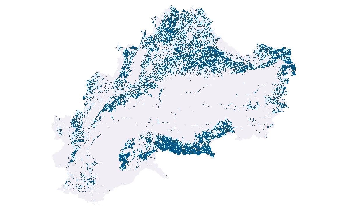
Permanently irrigated agricultural land is based on the corine land cover 2018 (CLC) from Copernicus. It has been extracted the permanent irrigated class, which is the class 12 in the CLC raster. The output is a binary raster, whereas 1 corresponds for permanent irrigated land and 0 corresponds to not permanent irrigated land.
collection, permanent irrigated land, presence of irrigation infrastructure, ADO project, ADO, cct, N/A, Land use, Land cover
Access to data is based on a principle of full, open and free access as established by the Copernicus data and information policy Regulation (EU) No 1159/2013 of 12 July 2013.
| Eurac Research - Institute for Earth Observation |
| bartolomeo.ventura@eurac.edu |
| Viale Druso, 1 / Drususallee 1, Eurac Research, Bolzano, Autonomous Province of Bolzano, 39100, Italy |


WGS-84 (3035:EPSG)
Grid
mapDigital
Imagery base maps earth cover
install.packages("openeo")
library(openeo)

# login ----
host = "https://openeo.eurac.edu"
con = connect(host = host)
login()

# check login ---
con$isConnected()
con$isLoggedIn()
describe_account()

# load collection - save result ----
p = processes()
data = p$load_collection(id = "ADO_factor_presence_of_irrigation_infrastructure",
                                             spatial_extent = list(west = 4.008928,
                                                                                 east = 17.508127,
                                                                                 south = 42.885755,
                                                                                 north = 50.318495),
                                             temporal_extent = list("STARTTIME", "ENDTIME"))
result = p$save_result(data = data, format="netCDF")

# download results ----
# either directly (suitable for smaller requests)
compute_result(result,
                             format = "netCDF",
                             output_file = "ADO_factor_presence_of_irrigation_infrastructure.nc",
                             con = con)

# or start a batch job (suitable for larger requests)
job_id = create_job(graph = result,
                                   title = "ADO_factor_presence_of_irrigation_infrastructure",
                                   description = "ADO_factor_presence_of_irrigation_infrastructure",
                                   format = "netCDF")
start_job(job = job_id)
result_list = list_results(job = job_id)
download_results(job = job_id, folder = ".")#pip install openeo
import openeo
# login ----
euracHost = "https://openeo.eurac.edu"
conn = openeo.connect(euracHost).authenticate_oidc(client_id="openEO_PKCE")
# load collection - save result ----
data = conn.load_collection("ADO_factor_presence_of_irrigation_infrastructure",spatial_extent={'west':4.008928,'east':17.508127,'south':42.885755,'north':50.318495},temporal_extent=["STARTTIME", "ENDTIME"])
result = data.save_result(format="NetCDF")
# download results ----
# either directly (suitable for smaller requests, closes the connection after 2 minutes)
result.download("ADO_factor_presence_of_irrigation_infrastructure.nc",format="netCDF")
# or start a batch job (suitable for larger requests, e.g. when .download() timeouts)
job = result.create_job(title = "ADO_factor_presence_of_irrigation_infrastructure",description = "ADO_factor_presence_of_irrigation_infrastructure",out_format = "netCDF")
jobId = job.job_id
job.start_job()
jobResults = job.get_results()
jobResults.download_files('.')| Name | Description | Link | Date published | Category |
|---|---|---|---|---|
| openEO for ADO project | Tutorial and snippets on how to use openEO in the ADO project | Link | Sept. 15, 2021 | OpenEO |
| EDP video tutorial | Presentation of edp-platform and tutorial for data analysis and processing | Link | Sept. 15, 2021 | OpenEO |
| Official OpenEO documentation and project site | Official Documentation provided in the project web site for a deeper overview and introduction. | Link | June 10, 2021 | OpenEO |
| OpenEO doc | Documentation for OpenEO API | Link | June 9, 2021 | OpenEO |
| Eurac - OpenEO | openEO endpoint | Link | April 28, 2021 | OpenEO |
| MOOC Cubes and Clouds | Free Online Course teaching the concepts of data cubes, cloud platforms and open science in geospatial and EO. | Link | March 8, 2024 | OpenEO, STAC |